

Last night, we arrived at Lachen from Gangtok. It is located at an elevation of 2,750 metres or around 9,000 ft. The name Lachen means “big pass”. It was a cold night, but the blanket provided by the hotel was very good. We felt cozy soon under it and had a good short sleep.
We woke up at 4.30 a.m. to get ready for visiting Gurudongmar Lake. It rained and snowed here in the night. It was a very chilly morning. Due to lack of power supply, the geyser was not working and we had to skip the bath in the morning. The temperature outside was around zero degrees centigrade. We covered ourselves with two jackets and left for Gurudongmar lake. I opened the window of our hotel room in the morning and was greeted by a lovely view of high snow-capped mountains.
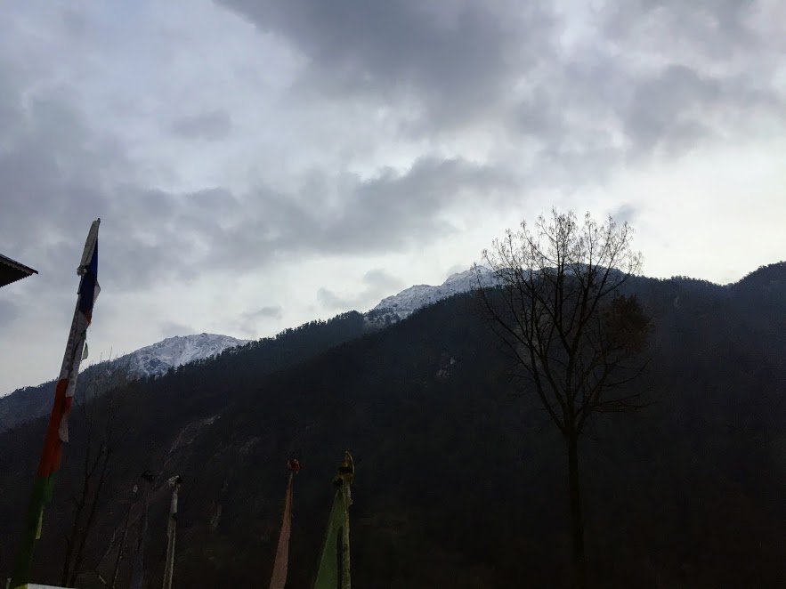
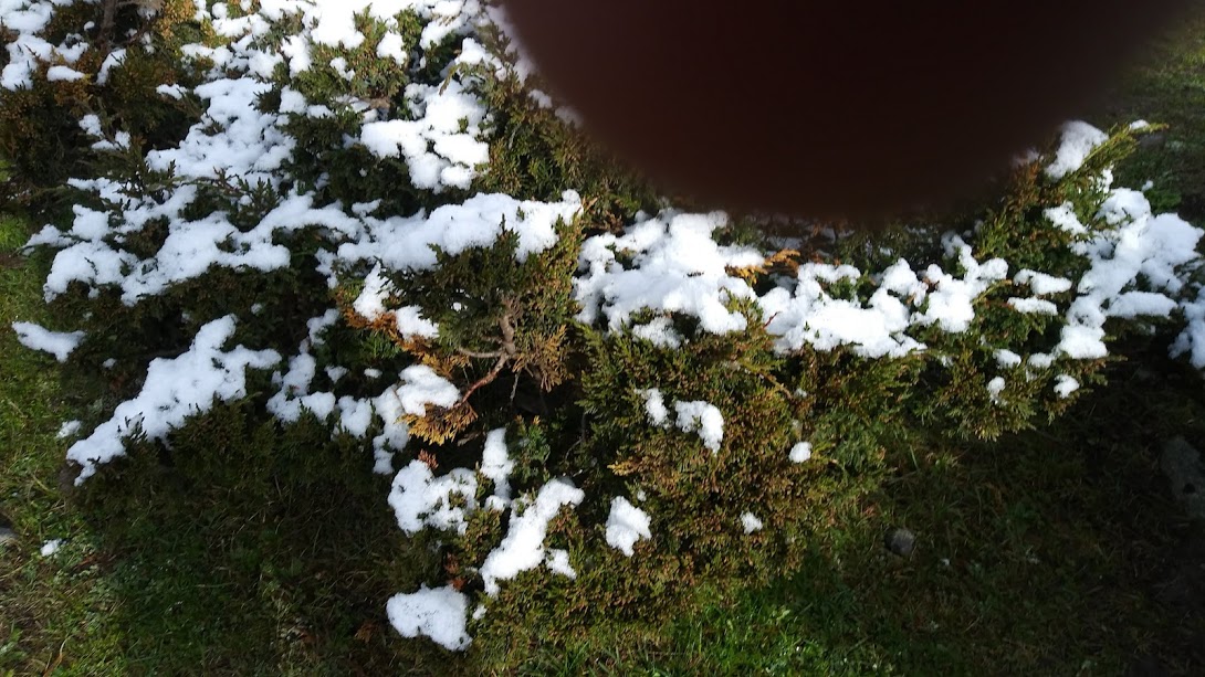
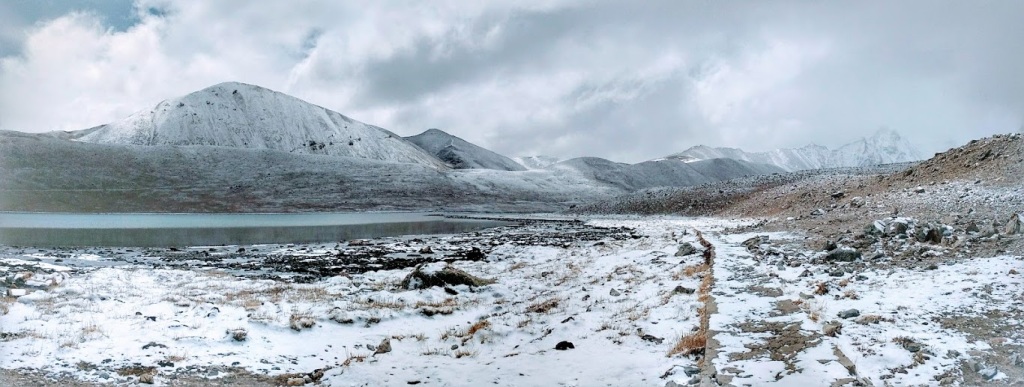
As we reached the road, we could see snow on the branches of alpine trees and bushes as if someone has spread cotton over these plants. With the Sun rising, these light layers of snow started melting revealing the beautiful artwork of the Mother Nature.
THANGU
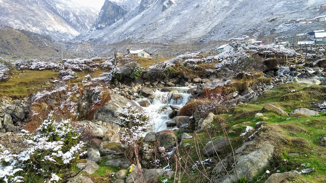
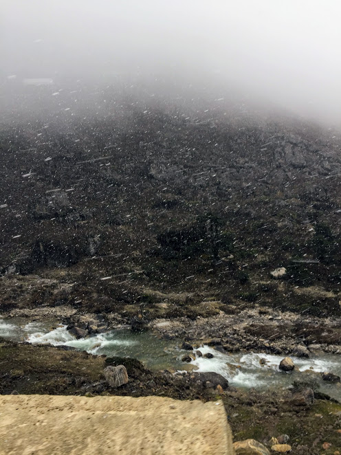
Our first stop was at Thangu, a tiny hamlet with only a handful of villagers and a large army base. Thangu, in fact, is the last Civilian Settlement along this route. Thangu is a valley with lush meadows located at an altitude of 13,000 ft and about 27 km north of Lachen. It takes about 1 hour 15 minutes to reach Thangu from Lachen. Within an hour or so the altitude changes by over 4,000 ft. So you can imagine how steep the road is. Thangu is in a way Indian Military base, where they stay for some time to get acclimatized. It is also a base for those who wish to trek to Chopta Valley and Muguthang. There is a check-post here and the driver went to the police check-post opposite the military area for completing the formalities. The calm water of Teesta flowing through the valley presents a fantastic contrast. Mostly inhabited by the Nomadic tribes, the valley of Thangu is trespassed and crisscrossed by a number of streams and rivulets, the most important of them are Chopta Chu, Thangu Chu and Lassur Chu.
There was a queue at the check-post as all the tourists are going to Gurudongmar lake at the same time. We just walked around nearby until the driver completes the formalities. There is a tiny stream flowing nearby. I went towards the stream.
A word of caution: since you are gaining altitude while driving on that stretch, your body is slowly getting acclimatized. It is suggested to not over exert yourself by running around, since the body is still adjusting to the lowering levels of oxygen. The best way to deal with this is to walk slowly, take deep breaths and let your eyes feast on what nature has to offer to you.
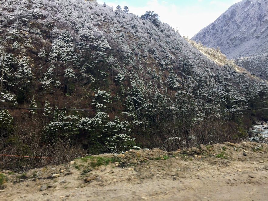
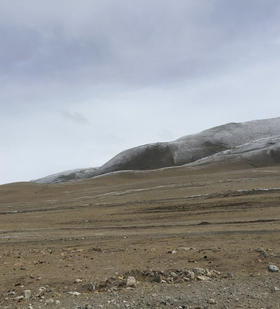
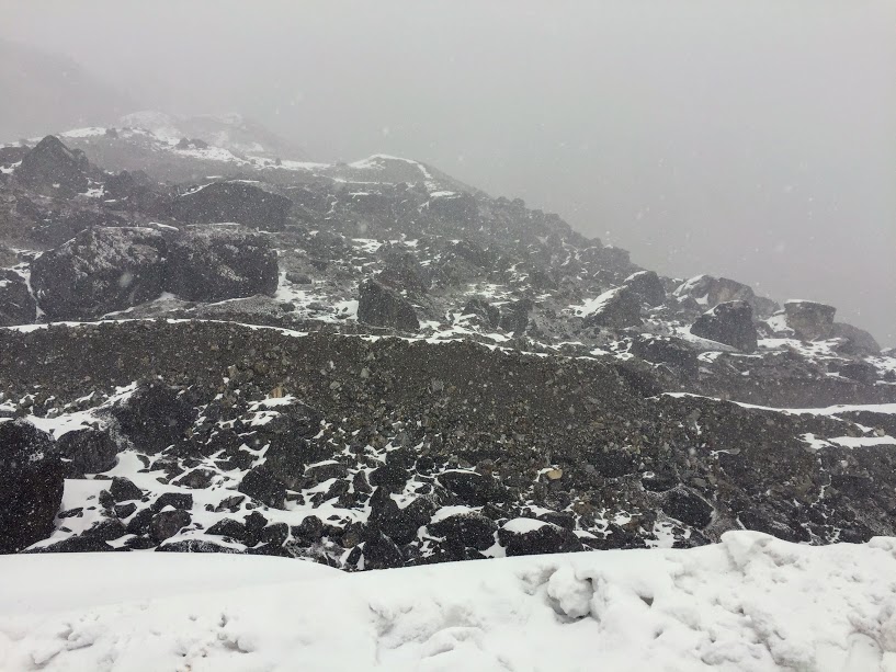
The change in foliage can distinctly be seen as we got to Thangu. From green forests or large trees, the foliage changed to mostly smaller bushes. This is the timberline a.k.a. tree line. Trees don’t grow above the timberline because of high winds, low moisture, and cold temperatures. Trees grow all over the world, in many different types of weather. But above certain elevations, trees just can’t grow. Trees at the timberline start to look more like low bushes than trees. Small trees need less moisture and less oxygen.
There are a few stalls here where you can take tea and have your breakfast. We had our breakfast at a small cafe. The small cafe was brilliant and snug — the kitchen a part of the dining area, making it warm and cozy. Our breakfast was hot Maggie noodles and tea. I tasted here salted tea for the first time. The locals here drink salted tea. Tribal communities in the high altitude hills of Himalayas drink salted tea. I have seen this during my visit to Kashmir also.
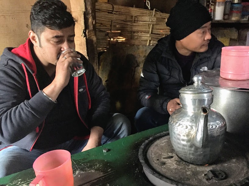
Adding a pinch of salt can also help in increasing energy as well as efficiency in the body. Salt regulates water balance and counterbalances the diuretic properties of tea. Consumption of salt tea can actually help in boosting the immune system. Not only this, but salt tea can also cure sore throat, and can keep seasonal diseases at bay. Himalayan salt can help in fighting many skin issues and adding a pinch of it to the tea could be quite beneficial for you. Zinc present in Himalayan salt helps in repairing damaged tissues and preventing acne. Moreover, sulphur helps in keeping the skin clean and smooth. Salt tea can help in relieving stress hormones and even promotes better health. This salt tea also helps in keeping you hydrated for a long time.
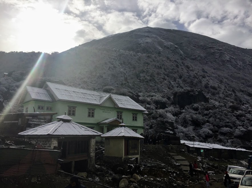
After a quick 20-minute breakfast break, we started off for the final ascent towards Gurudongmar Lake. The hairpin bends started increasing, and it was easy to realize that we were quickly gaining height. We stopped sighting the occasional shepherds and shacks, and the frequency of army checkpoints and posts increased. There is a major army check-post very close to the final venue at Giagong, where all our ID cards and permits were checked. This check-post had an army-run cafe and medical facilities available too for the public.
GURUDONGMAR LAKE
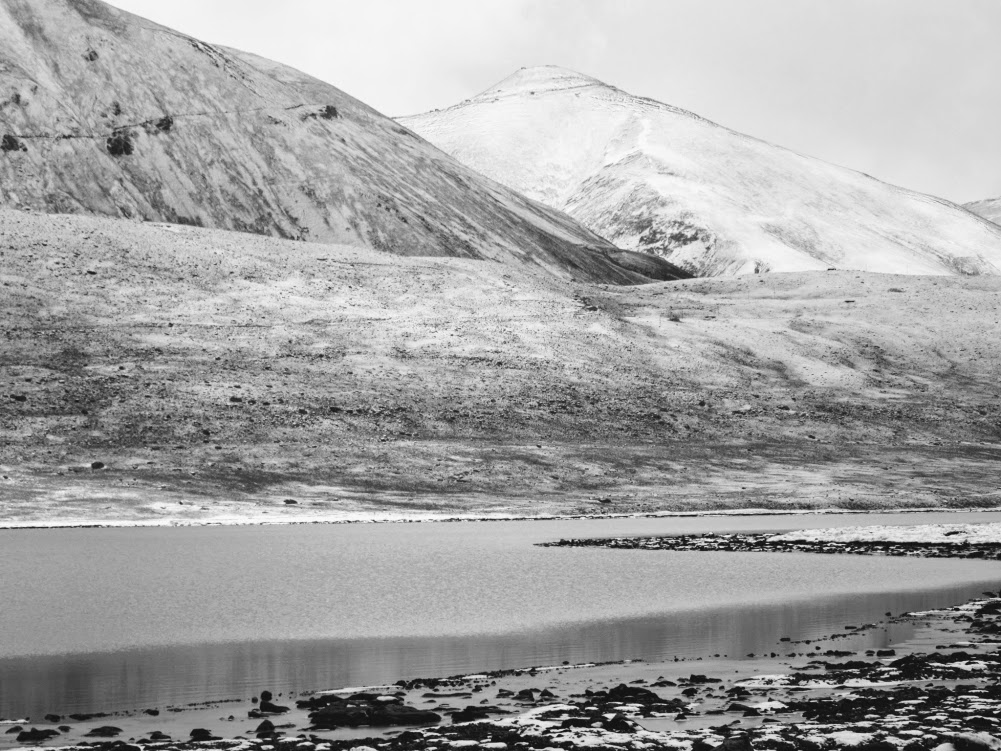
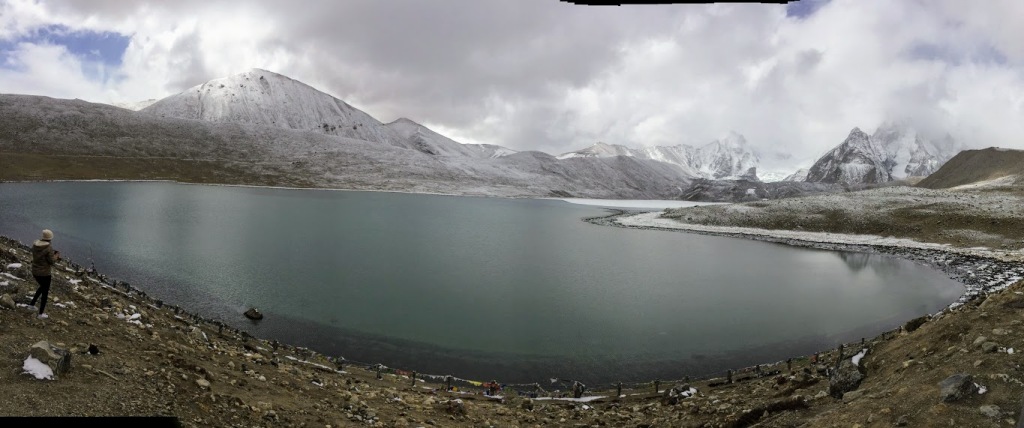
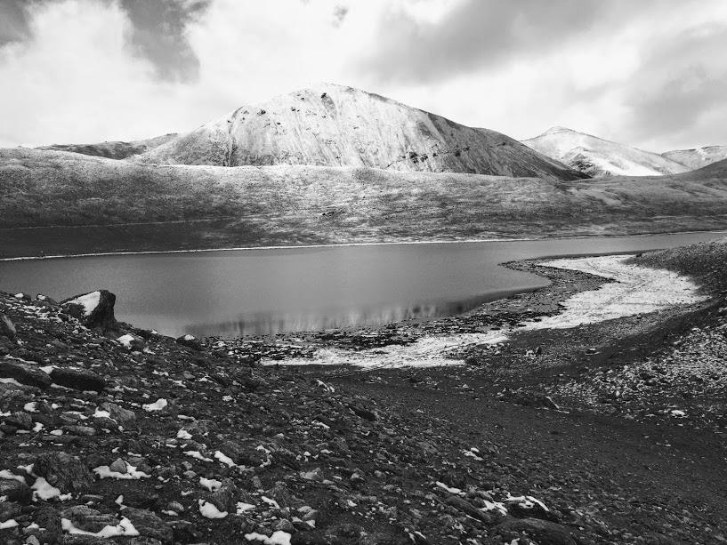
Indians are allowed to visit Gurudongmar Lake while foreigners are restricted till Chopta Valley and Yumthang Valley. The India-China border is just a few kilometres away from the lake. Gurudongmar lake is located at a surface elevation of 17,800 ft (5,430 m) and covers an area of 290 acres making it the largest lake in the whole of Sikkim.
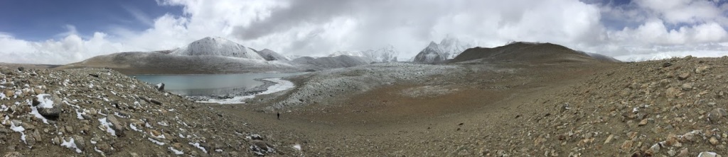
The lake ranks among the top 15 highest lakes in the world and is the second highest lake in India, the first being Cholamu lake at a height of 18,000 ft (5,486 m), also situated in Sikkim. Cholamu Lake is only a few kilometres away from the Indo-Tibet border and is off limits for commonplace tourists. One needs special permits, from Army and Sikkim police/ administration to visit the Cholamu Lake. Also, travel agencies mostly don’t risk their vehicles and driver in the risky terrain to Cholamu lake.
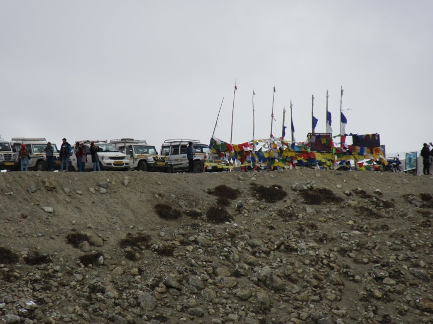
The lake lies in the north side of the Khangchengyao range and is surrounded by snow-clad mountains making it a stunningly picturesque site — a half-frozen lake, snow-clad mountains in the background, colorful Buddhist flags fluttering in the strong wind, and a small army built a temple. The sacred lake freezes during the winters except at one spot, which the devout belief has been specially blessed.
Gurudongmar Lake is a sacred lake in the Great Himalayan Region. This is the largest lake in Sikkim and considered very sacred by both Buddhists and Hindus. Babai and I climbed down to the lake. There is a pavement for walking around the lake. It was however slippery as the snows melted. Babai and I walked around 300 meters by the lake and then returned.
The Buddhists and Hindus believe that this specific area is blessed. In fact, the whole lake is considered holy and is believed to be having many healing powers. Buddhist prayer flags are seen fluttering on the sides of the lake.
Despite the hardship and difficulty, a visit to this lake will last in our memory as an experience of a lifetime. Thank God, we didn’t feel sick at the high altitude and with low oxygen level. The weather near Gurudongmar usually starts becoming bad as the day progresses, so we left the lake area early.
CHOPTA VALLEY
On our way back from Gurudongmar lake, we stopped at Chopta Valley located at 13,200 ft near Thangu. It’s only 2 km from Thangu towards Gurudongmar Lake. This is a picture perfect valley. At an altitude of 13,200 ft with meandering rivers as Thangu, Chopta, Lassur Chu, the high altitude snow-capped peaks and lush green valleys Chopta Valley is one of the best landscape one can experience over at North Sikkim. It had started snowing then. We drove through as it was snowing. Slowly, the sides got covered by snow.

KALA PATTHAR
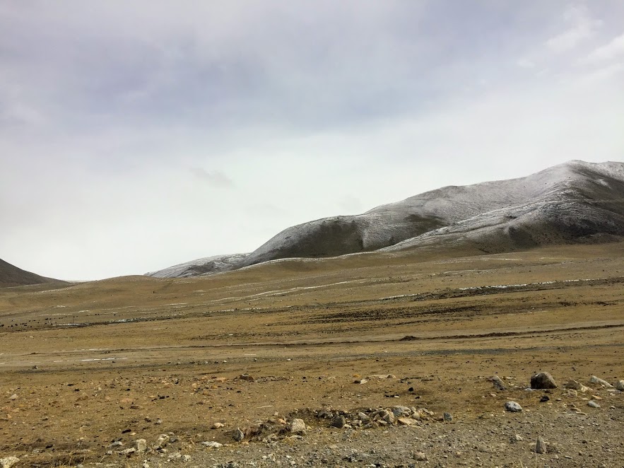
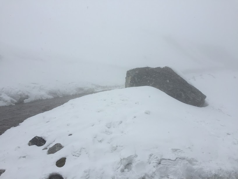
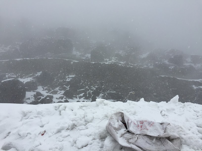
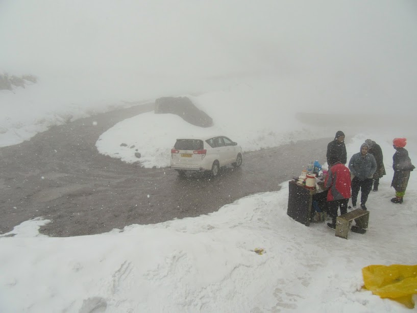
There is a new tourist destination further Chopta towards Muguthang Valley named “Kala Patthar” — situated at an elevation of 14,850 ft. It’s not included in the regular package. The taxi drivers take tourists to this on payment of additional amount of Rs 3,000 ($46). We agreed for the detour to Kala Patthar. This place got the name as there are mountains with snowy peaks and black cliffs.
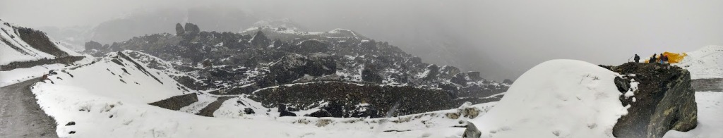
Kala Patthar is normally uninhabitable except for some occasional settlements by Tibetan nomads for grazing their Yaks. The motorable road ends at Kala Pathar at 14,850 ft. And it is a dead-end.
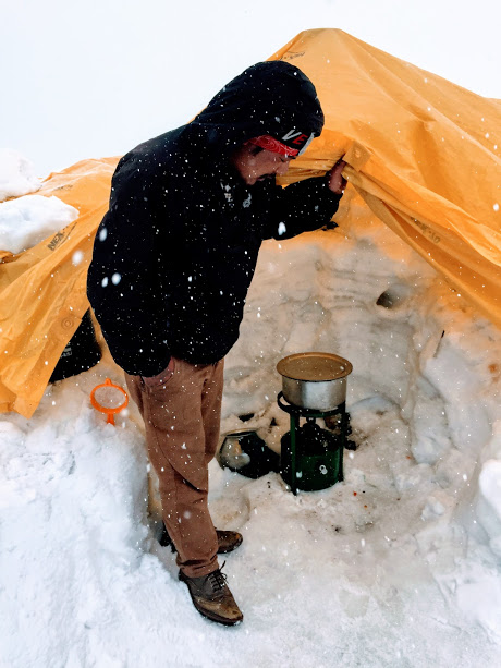
When we arrived Kala Patthar, it was snowing. There was snow all around. I haven’t seen so much white in my life. When we reached Kala Patthar, it was snowing there.
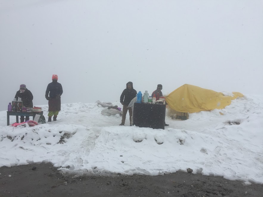
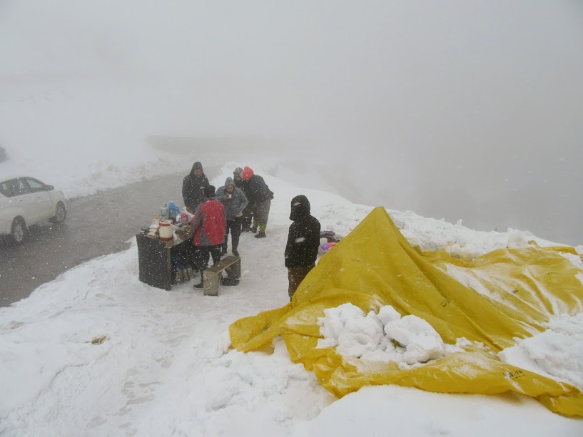
We walked around on the snow, had a cup of hot coffee prepared over snow under a plastic cover since it was snowing there. There was a couple of stalls selling tea, coffee, boiled eggs and brandy. We also had shots of brandy with boiled eggs to keep us warm.
It was a lifetime experience. We were enjoying the place fully.


After being there for around half an hour, we returned to our hotel at Lachen for lunch. We had our bags packed already. So, we left the hotel soon after our lunch for Lachung, around 48 km from Lachen.
BHEWMA WATERFALL
For going to Lachung, we had to come down to Chumthang. After crossing Chumthang, we stopped at a waterfall, named Bhewma (meaning red snake in local dialects) falls. Bhewma Falls has a height of 275 metres. In the local dialect it means Red Snake. It is also known as Amitabh Bachchan Falls, after shooting of the film Aankhen at the spot.


There is an wooden platform made by the villagers (with bamboo and logs) so that you can go close to the waterfall, but to need to pay Rs. 10 per person to walk on that. Since we can have better view of the waterfall from the road we enjoyed the view from the road sipping hot tea from one of the stalls there.
LACHUNG
We then drove to Lachung, Lachung is at an elevation of about 9,600 feet (2,900 m) and at the confluence of the Lachen and Lachung Rivers, both tributaries of the river Teesta. The word Lachung means “small pass”. The town is approximately 125 kilometres from the capital Gangtok. Lachung is known for its stunning scenery, rich culture and friendly people. It is also a gateway to some of the most amazing places in the Himalayas, such as Yumthang Valley and Zero Point.
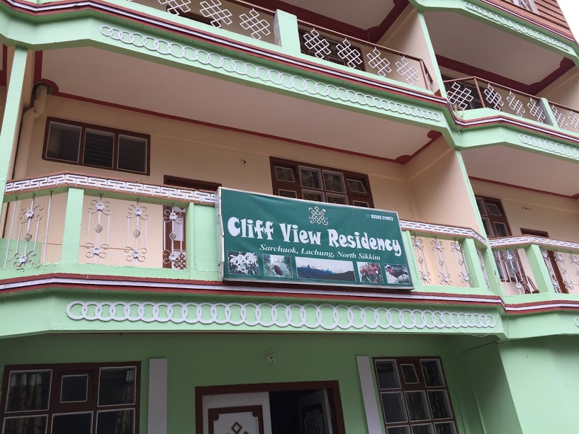
Our hotel, Cliff View Residency, is slightly off from the main town so we dropped the idea of exploring the town in the evening. Also, we were tired. So, we preferred to stay in the hotel, relaxed, had dinner and slept to get ready to visit Zero Point and Yumthung Valley next day.
Before the annexation of Tibet by China in 1950, Lachung was a trading post between Sikkim and Tibet. All that’s long over now, but Lachung’s economy has been boosted by tourism in recent years as it’s a stopover to Yumthang Valley. It is a place where you can find peace and beauty in abundance. I hope you enjoyed reading this blog post and I will see you soon with more travel stories. Bye for now!

Such an amazing post! Thank you for posting picture of this holy lake, it is breathtaking!
LikeLiked by 3 people
Thanks, Shivangi.
LikeLiked by 2 people
Indro, you took me through a mind boggling journey. The pictures speak a thousand words.
Now awaiting for the final part – Zero Point.
LikeLiked by 1 person
Thanks Aro, for your compliments. 🙂
LikeLiked by 1 person
Following your lead. I am on a month long trip to the North East and will be heading soon there from Arunachal Pradesh. Lovely pictures. Nothing matches the serenity of the mountains….
LikeLiked by 2 people
Thanks, Rajat. The natural beauty in North East is unrivalled. So, we will be treated with some amazing pictures and great posts. Waiting for your posts. Have a wonderful trip!
LikeLiked by 2 people
Thank you. And wishing you a splendid journey . I keenly await your discoveries too..
LikeLiked by 2 people
😄👍
LikeLiked by 2 people
Pingback: North Sikkim | Day 3: Lachung-Zero Point-Yumthang Valley-Gangtok – Indrosphere
Would love to visit this part if India sometime 🙂
LikeLiked by 1 person
Yes, do visit Sikkim. It’s a wonderful place.
LikeLiked by 1 person
I visited Sikkim five years ago and lost my heart to her! ☺️ Your pictures are beautiful! Hope you have a scenic, blissful and safe journey ahead. 😃😊
LikeLiked by 1 person
Thanks, Natika. You’re right. Sikkim is so beautiful that anyone can fall in love.
LikeLiked by 1 person
Beautiful pictures! Gurudongmar is such a wonderful place…pristine…
LikeLiked by 1 person
Thanks, Maniparna.
LikeLiked by 1 person
Enjoyed reading this..
LikeLiked by 1 person
Thanks, Neethu .
LikeLike
Reblogged this on jayaspace.
LikeLiked by 1 person
Sikkim is in my travel list….I will really update as soon as I visit… Beautiful pictures and beautiful place😃😃😃
LikeLiked by 1 person
Wish your dream comes true soon. You’ll love the place. Waiting for your post. Cheers.
LikeLike
Cheers😃😃😃😃
LikeLiked by 1 person
Beautiful narration and awesome pictures. The snow-covered hills and trees look beautiful. The post reminded me of my trip to Sikkim and Nathula, long back in the month of December.
LikeLiked by 1 person
Thanks, Somali. Yes and you might also have seen the serene lake at Tsomgo. In December, it might be frozen completely.
LikeLiked by 1 person
Yes, Tsomgo Lake or Changu Lake was completely frozen. One could walk over it.
LikeLiked by 1 person
We visited Tosmgo (Changu) lake in March and the lake had melted completely a few days before. The mountains were all covered by snow. You may read: https://wp.me/p10bZs-2hv.
LikeLiked by 1 person
What a fantastic experience and write-up. And reading about snow sitting in 44C in Gurgaon…envious.
LikeLike
Thanks, sir. I feel honoured.
LikeLike
Articulated so amazingly!!!! And filled with tonnes of knowledge…
LikeLiked by 1 person
Thanks, Nishtha for your nice words.
LikeLiked by 1 person
Its a wonderful travelogue. I would like to know how did you manage the permit a day before. Is there any agent whom I can contact a day in advance.
Because I am also planning to go to Sikkim next week. Don’t want to waste a day for the permit.
LikeLiked by 1 person
Thanks, Srilakshmi.
You may ask your hotel guys. They can it done through some taxi driver or a travel agent. I hope you’ll spend at least a day in local sightseeing and it can be arranged by then.
LikeLike
Is there any agent whom I can contact a day in advance?
LikeLiked by 1 person
We used the services of Mr. Samunder Singh. You may contact him for details at +919434629950 / +919735918399 / +919434011467 or his website.
LikeLike
Lovely location and stunning photographs 🙂
LikeLiked by 1 person
Thanks, Abhi.
LikeLike
Very well written. Am going on 25 th may 2019. Got a lot of information from your post.Regards
LikeLiked by 1 person
Thanks, Indranil. Wish you a pleasant trip. I am sure it will be one of your most memorable trips. Sikkim is simply awesome.
LikeLike
That’s a lovely and a detailed blog! Would you mind sharing how you worked on logistics and car? Any recommendations on logistics or tour guides? Though I would love to do a self tour
LikeLike
Ah, an excellent post, it seems I have been reliving the moments of my recent visit here. You were lucky to see the unfrozen lake. Great post with beautiful pictures.
LikeLiked by 1 person
Thanks, Sharmistha. We love what we miss. I loved your snow-ful images. 🙂
LikeLiked by 1 person
Haha, thats right the “grass is always greener on the other side”.
LikeLiked by 1 person
True. 👍
LikeLike
बहुत खुबसूरत वर्णन, ऐसा लगा हमारी ही कहानी का वर्णन किया है आपने । हम भी गए थे मई 2019 को ।
LikeLiked by 1 person
धन्यवाद, फाल्गुनी! गुरुडोंगमार झील एक यादगार यात्रा है।
LikeLike
Pingback: Lachung-Zero Point-Yumthang-Gangtok – Indrosphere